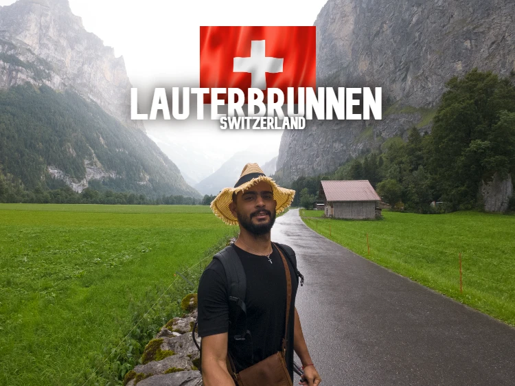
I woke up early, around 6:30 am, my goal there was to capture the best videos of the sunrise from the top of the mountain. Pico Ruivo is 1861 meters high. I saw the most incredible sunrise of my life, from the top of Pico Ruivo. Incredible feeling of being at the top, seeing all that horizon. Madeira Island is truly perfect. Several people had camped there, I counted 6 tents in addition to mine. It was a quiet night, not too cold.
The Top of Pico Ruivo
After taking the videos from the top of Pico Ruivo, I went down to the support house and went to have breakfast. I ate the famous Madeira honey cake, ordered a cappuccino and cookies. I also took some other things to help me continue on the trail. On this day, around 10.5km awaited me and the objective was to sleep at the summit or as close to it as possible.
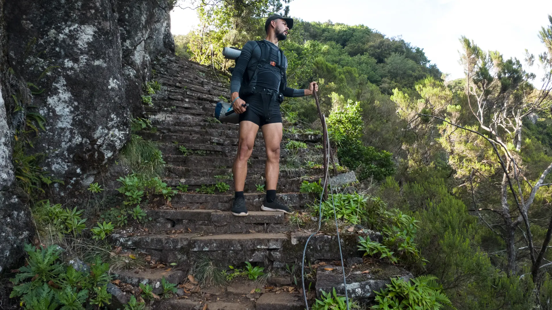
I confess that this was one of the most different days of the entire trail. The route from Pico Ruivo to Encumeada is PR 1.3, one of the longest and most challenging. It comprises around 11km from Pico Ruivo to Encumeada, with several ups and downs, a path full of rocks, irregular and extremely dangerous terrain. On the trail the stones are loose, if you step wrongly or incorrectly, you can fall and get hurt. On this day it didn’t rain, so the trail was safer and easier to do. However, with as little rain as there is, I recommend that you be very careful or even stop and wait for the rain to pass.
Curral das Freiras
As soon as you leave Pico Ruivo, you will find a very steep and dangerous descent. Even going down is tiring and dangerous, make no mistake. At least this part of the route is downhill, but the trail is not very wide, at certain times you have to stop for other people to pass. If it’s raining it becomes even more difficult. Yes, there are several people passing along the trail, Germans, French, Dutch, English, but I saw very few Portuguese. At the bottom of the valley it is possible to see the village of Curral das Freiras, a municipality with a population of around 2000 people, being the largest parish in the Câmara de Lobos Council, in Madeira.
PR 1.3 and the vegetation of Pico Ruivo
On this route, changes in vegetation can already be seen along PR 1.3. A more mountainous vegetation, with trees twisted under the mountain, aged and which undoubtedly tells a lot about the history of that place. On the right side you can see more humid vegetation, with a lot of clouds and fog, so much so that it is possible to see some water springs on the right side of the route. It is possible to fill your bottle with water, but you must pay attention to where you drink from.
Precautions when drinking water on trails
What the locals tell me is the following: If you drink water from a rock spring, there is no problem, but avoid drinking water directly from the levadas, as a lot of dirt tends to fall, people could touch the water or spill something unwanted. . So I did, I preferred to drink water only from the springs in the middle of the rocks, and in fact, the water has a better taste, in addition to being very fresh and quenching my thirst.
Talking to locals about the trails
Halfway along the way I met Nuno Gonçalves and his wife, a Portuguese couple who were doing the trail, the only Portuguese I met on the trail that day, the others were from other countries, mostly from Germany. They live in the municipality of Curral das Freiras. We met right on the way down Pico Ruivo, so we continued from there until the fork further ahead. They say they have been hiking for a long time, both together. Nuno was born and raised there in Madeira and knows the region a lot. He said that before there were different trails that were replaced over time to facilitate the growth of tourism. He also says that sometimes, there are cases of people who go out alone on the trails and get lost or disappear, he says that this happens because people underestimate the trails and think it will be easy, or they aren’t careful and end up slipping on the trails, or go hiking in rainy times. What is more common are missing people. He said that there is a race on Madeira Island where there are more than 1000 participants, this race covers around 112km, crossing the island from Porto Moniz to Funchal, and participants do this race in 12 hours, running without stopping. It’s a race that usually takes place at night, so people go there to train at night, just like the race. This is a big reason why people sometimes get lost on the trails or have an accident.
Boca das Torrinhas, Curral das Freiras and Urzal
At a certain point on the trail, you will find an area with several different paths, this place is called Boca das Torrinhas. On your right is the trail to Urzal, called PR 2 – Vereda do Urzal. On this trail you will head towards the north of the island, and you will find part of the Laurissilva Forest in its original state. Following this path, always going downhill, you will arrive at Lombo do Urzal, in the parish of Boaventura.
I got Bread, Sardines and an Orange from the locals
Arriving in Boca das Torrinhas, Nuno gave me an orange, a piece of bread and a can of sardines with tomatoes, he said he wouldn’t use them anymore, he was already close to home and would be more useful to me, and he was. We said goodbye. He headed towards Curral das Freiras and I, just in front of Boca das Torrinhas, sat down and went to eat what I had just received from Nuno. Everything was very good, I ate the bread with sardines and orange afterwards. This way I had enough energy to continue until the end of the trail. From there I went on my way, I had already eaten and now I had energy. After Torrinhas there is a good climb, with steps reaching 50cm, very high. Just ahead there is Pico Jorge, 1691 meters high, with a beautiful view of Curral das Freiras.
From then on the trail gets easier, as Pico Jorge is the highest point in that area, so you will only go down from there.
Springs and Water Sources
Keep in mind that there are water springs along the way, where water comes out of the rocks. The locals say that when water comes from the rock, it is better to drink, it would be more filtered, without impurities, the opposite of the levadas. I will mark on the map below the approximate point where I found one of these water sources directly from the rock, fresh and clean water coming out to drink.
Be careful with the springs, as the path becomes more humid and wet and may slip.
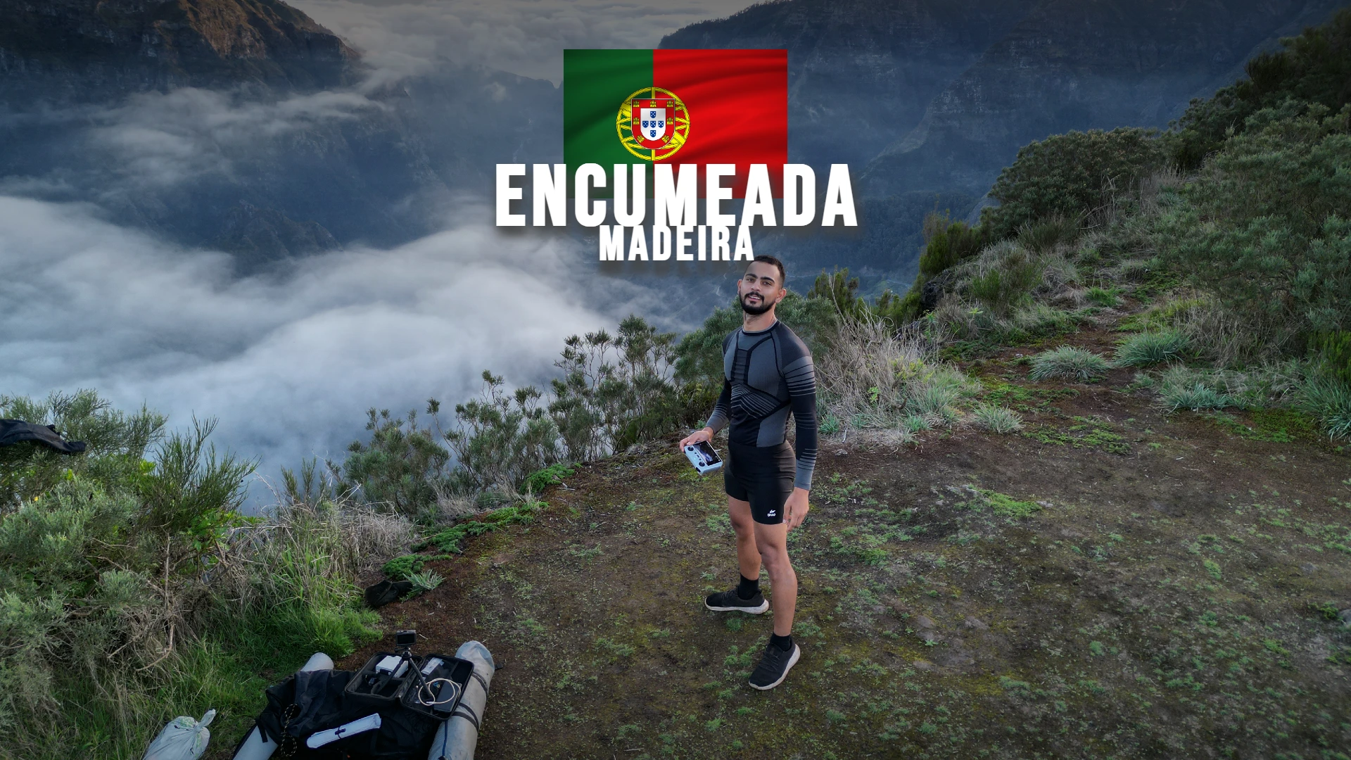
Arriving at Encumeada
Little by little I arrive at Encumeada. There are 2 or 3 interesting spots to pitch your tent and spend the night. I will leave it marked on the map below. Be careful as these are unauthorized areas, so keep in mind that it is an emergency case where it is already dark, you cannot continue on the trail and you need to find a place as quickly as possible to spend the night, this was my case. I don’t recommend hiking at night, it’s super dangerous, so this information is to help you if you really need it.
I camped in the middle of the mountains of Madeira Island
That’s what happened to me, night came and I was on the trail, I had to take shelter somehow. I pitched my tent there, in a more open spot, a kind of viewpoint, where you can see Ribeira Brava on one side and São Vicente on the other. It was an incredible night I had there. No rain, no wind, no cold, not too hot, I had an ideal temperature.
I still had some bread, crackers, tuna and water, my perfect dinner. There was no longer any food for the next day, only the next breakfast for the next day. So, luckily, I was already very close to a little shop where I could eat even better the next day, but I didn’t know that until then. I took some drone videos, photos, ate and went to sleep.