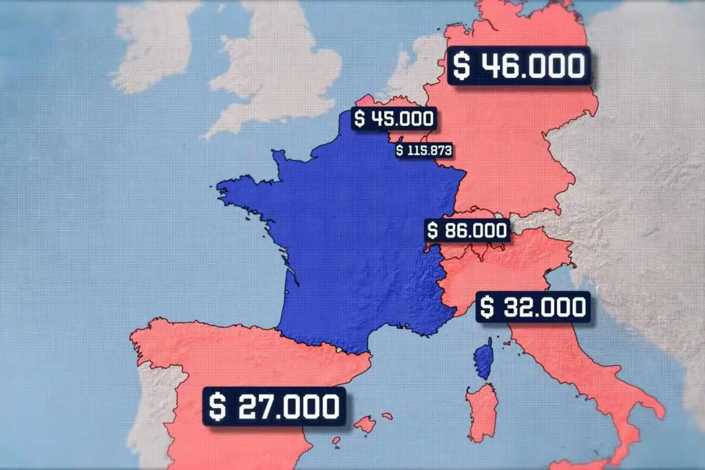
France, the 7th largest economy in the world and a powerhouse for much of its history, but this was perhaps only possible thanks to its practically perfect territory. Let’s take a look at its neighbours. This is the GDP per capita map of the countries around it, you can see the wealth that circulates around France. To the east on its largest border we have the richest and most developed part of Italy, the north of that country. Above it we have Switzerland, the country with the richest population in all of Europe. On its side Germany, the richest country on the European continent, and then Luxembourg, Belgium and finally Spain.
These are territories connected directly by land, but up here we have an important region, the island of Great Britain. So let’s look at these Borders one by one.
How Did Spain Influence in France?
Starting with Spain which shares a border with France, to the north east we have the four Spanish autonomous communities. Starting with Catalonia, the second wealthiest state in the country, then Aragon, Navarre and a small border with the Basque country.
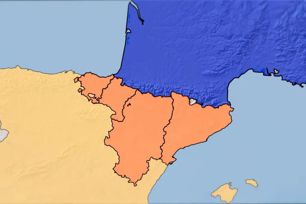
These are important Spanish regions that looking at the geography of this region in another way, we have the Pyrenees, a huge mountain range that divides France and Spain, being an extremely important region and served in its history as a defensive shield.
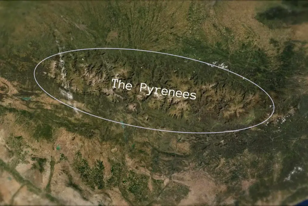
The Pyrenees Region
In the 8th century, Muslims dominated the whole of North Africa. In 721 they already dominated the whole Iberian peninsula and their next objective was to pass through The Pyrenees and thus dominate the region of the Franks. The Pyrenees barred the entrance of an army through almost all the territory with a border of the Frankish kingdom, with the Muslim Saracens being able to pass through the right side, a flatter region and that’s exactly what they did. Dominating some towns in that region, but in the same year, in 721 they were repulsed by the Frankish army.
The point is to understand the importance of this region for France and that if it were not for it, whole armies would have free access to the south of the country and so could attack from several different fronts.
France’s connection with maritime trade
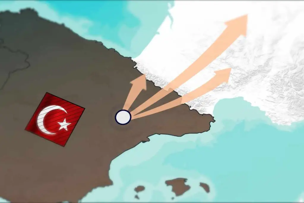
Leaving here we head north and this is perhaps the most important region for the whole of France. A first factor being the very important seas. Coming from the north the ships necessarily pass through the English Channel, then the Celtic Sea, also passing through the Bay of Biscay, to finally reach the Straits of Gibraltar.
This is a map of the cargo ships that pass through the region and make, as said before the whole journey. The big point is that this is the busiest canal in the world and France obviously benefits from this as it is close to the Netherlands, the biggest export centre in Europe.
The Importance of Eurotunnel
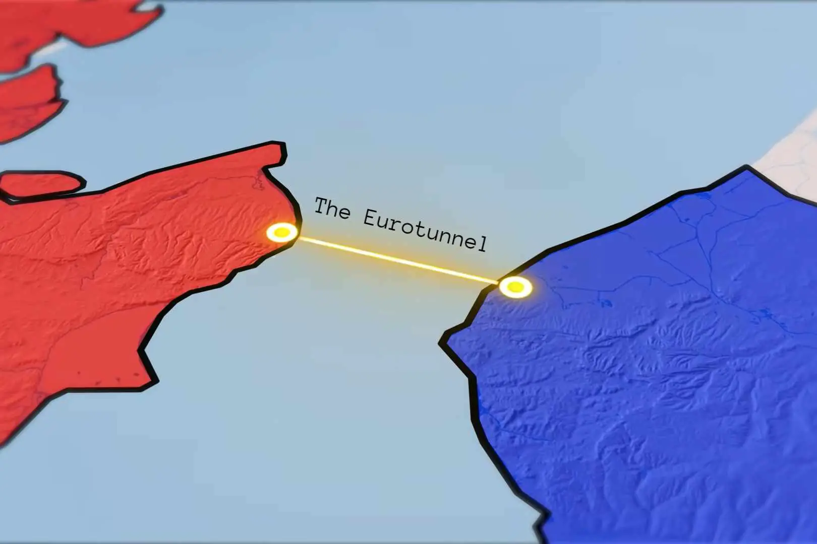
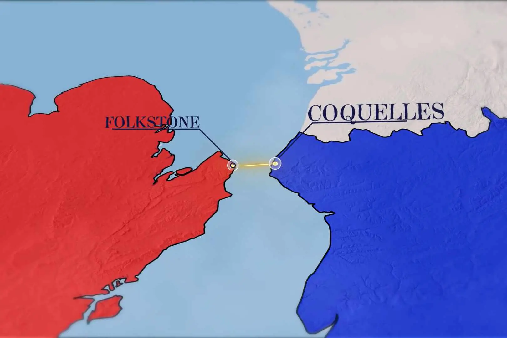
As well as the UK, another giant exporter, the ports of CherBourg, Calais, Le Hevre and Deauville benefit greatly from their position on the English Channel. If we get closer we have the Eurotunnel. Because of France’s proximity to the UK, this has allowed both countries to build this Rail tunnel which links Folkstone in the UK to Coquelles in northern France.
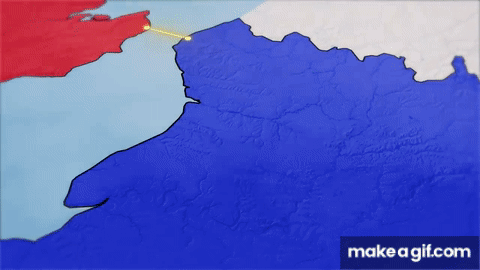
Not only that, but we also have a gigantic connection from Paris to the northernmost city, Arras, and then a new line continues from Arras to the entrance of the Eurotunnel, but here we have a caveat, a new line comes from the city of Brussels, in Belgium to its connection with the French line. Finally it continues to the immense and richest English city, London.
The importance of this whole line, is that besides transporting passengers and make everything much faster and easier, we also have the transport of goods. The amount spent to hire a ship from the port of Calais in France and charter it to the city of London in the United Kingdom would be much more expensive than a fast rail connection between the two countries.
How important is the River Seine for France?
In addition, one of the most important features of France are the dozens of French rivers that make up the country, the most famous perhaps being the Seine River, which flows into the English Channel, and as we saw the importance of the English Channel earlier, products and people can follow the Seine River into the interior of France.
Going from the English Channel, the Seine River passes for example through important cities like Rouen, Melun, Sens and dozens of other smaller cities in the French countryside. The point here is rivers are extremely favourable for development, as they link cities more quickly, are sources of energy in hydroelectric power plants and serve as a supply base for large cities.
French rivers and agriculture
The French rivers running through the French countryside have made France a powerhouse in European agriculture, no wonder France is a third largest European country in terms of agricultural exports. French land is extremely productive and the amount of arable land in France is second only to Ukraine and obviously by size, Russia.
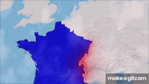
The European Great Plain: France’s weak spot
But now, in the East, is where France stands out the most. In the south-east of France, with its border with Italy something similar happens in the case of the Pyrenees. In this region we have the Alps, a mountain range that stretches from Austria to southern France, blocking the entrance of possible invaders. Above, France and divided with Germany across the Rhine River. This immense division prevented enemies from advancing into the south of France, such as the great German invasion of 1940, with the German fronts invading from the extreme north of France, as in this region there is the great European plain, which is an immense flat land where France is practically open to invaders and gives them easy access to the interior of the country.
German Invasion
The fact is, the three times Germany invaded France it was exactly through this region. First in 1870, then through the same region in 1914, and finally in 1939, and during the Second World War and that is the only French point and really the worrying one when we talk about possible invaders in all its history.
The Mediterranean Sea
After here, we have another extremely important region for the French, the Mediterranean Sea. France is the only European country and has access to both the North Sea and the Mediterranean Sea at the same time. Having access to both seas, French products can quickly be exported to three different regions.
First through the Strait of Gibraltar on the Road to the Americas, also to the Black Sea and mainly to the Suez Canal, where it has access to all of Asia. The great advantage of this is that goods coming from other regions can easily pass through the Port of Saint-Louis and thus enter the Rhône River, and in this way finally go inland to France.
This is the logic of France’s insane geography, it has access to four different seas in three different regions. It borders extremely rich countries and its geography is perfect against enemy invasions. And this is the exact reason why the geography of France is extremely perfect: Natural defence by the border