China, perhaps the most important country in the whole of Asia, but right next to it we have India, another Asian economic and military power. These countries are divided by a huge mountain range called the Himalayas. This mountain range has served as a natural barrier between both countries during their history, and this is where the biggest territorial dispute in the world begins.
China is the most populated country in the world, while India is the second most populated country and this makes both of them vying for the throne of the most influential country in Asia. China, for example, in an attempt to increase its influence in the world, is building a belt of mega-projects and highways that link the country to several others across Asia, including India’s enemy countries like Pakistan.
In response, the Indian government is militarising its border with China much more year after year. To understand all this let’s look at this situation end-to-end.
Where did the dispute between China and India come from?
The conflict over this region dates back to 1914, when the British Empire, which at the time ruled India, drew a line between India and Tibet, with the Chinese not respecting the boundaries.
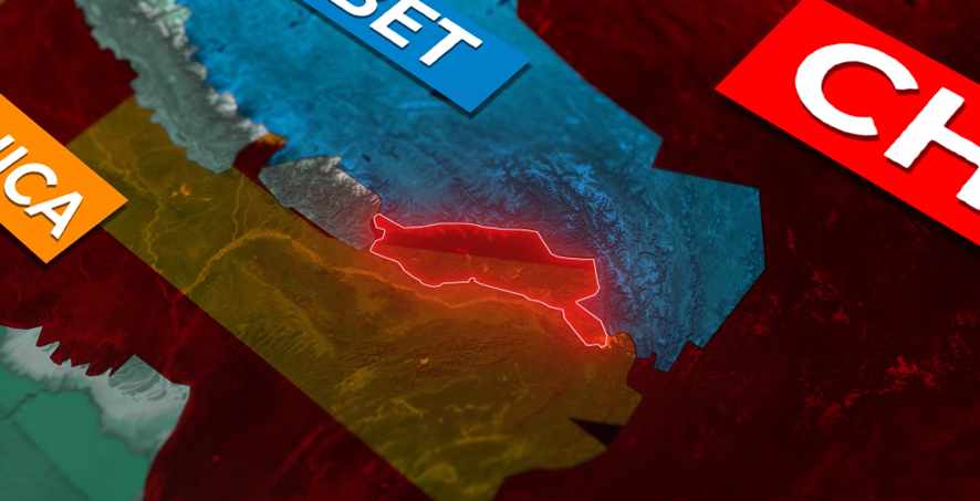
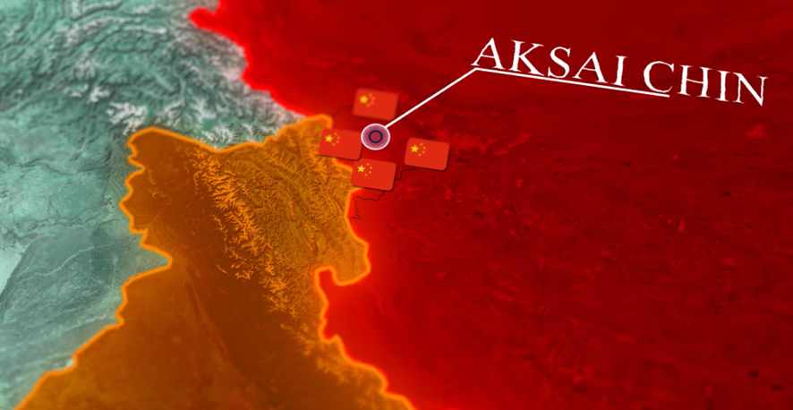
But it was only in 1962 that the Chinese invaded Indian territory to the north and came to control the AKSAI CHIN region to this day.
The current conflict in the region
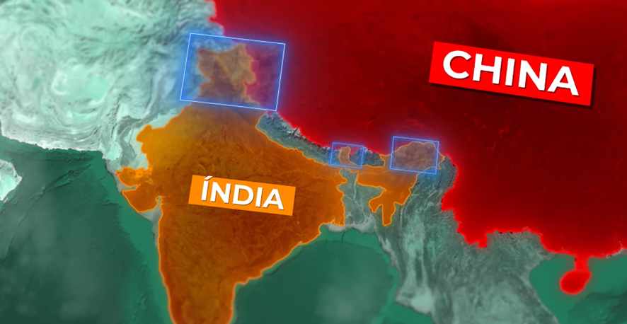
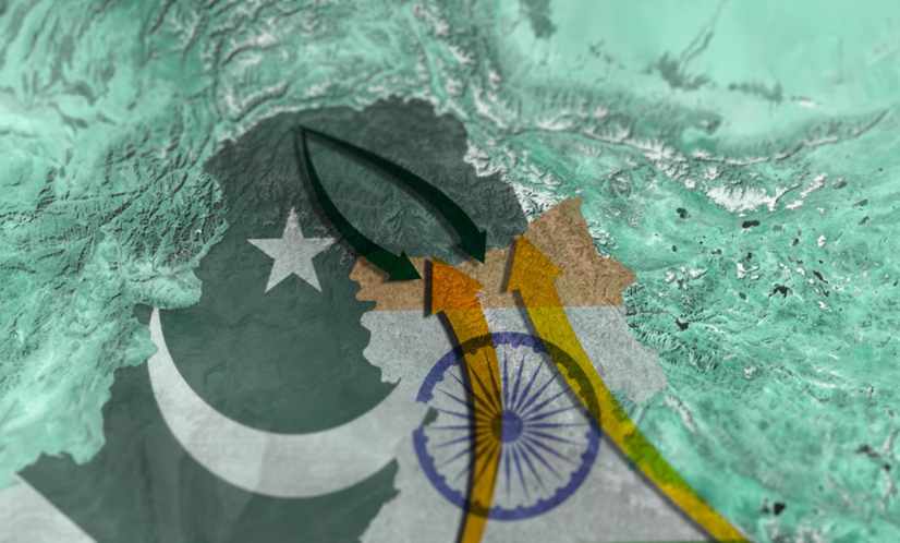
Today the conflicts in that region are divided into three different parts, being the Kashmir region in the North West, the Central Area and finally Arunachal Pradesh.
But focusing on Kashmir which is the most militarised and highest conflict region, there are three main conflict areas, being the Indian Kashmir region administered by India, the AKSAI CHIN region administered by China and the Pakistani Kashmir region, administered by Pakistan. With the Indians claiming control of all three regions. The Pakistanis, on the other hand, claim only the territories under Indian control.
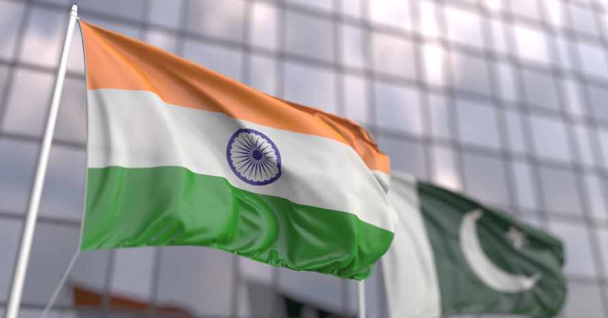
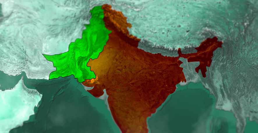
This is because both countries were once one, given that in 1947 India and Pakistan were on the verge of independence from the British, so the British Empire of India split into the states of India and Pakistan.
At the time the British Empire of India was made up of several smaller states that were part of the empire but were led by a monarch.
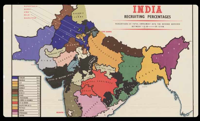
With the partition, this meant that the monarchical states could choose whether to cede India or Pakistan. In general, the Muslim states integrated Pakistan, while the Hindu states integrated India. However, Kashmir was a peculiar case, since the ruler Maharaja was Hindu, but the people of the region are mostly Muslim, and this led to several conflicts between the ruler and Muslim militias.
The First Kashmir War
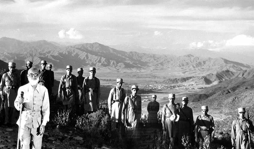
The ruler, in an attempt to stop the militias and rebellions, asked India for help and in doing so ceded Kashmir, and it was at this point that the First Kashmir War began, which was fought between Indian soldiers and the Pakistani tribes. This has led to today’s rivalry between the two countries for control of the region.
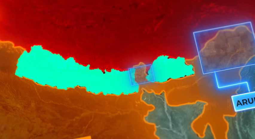
But leaving that region and looking at the other part of the territorial dispute, in the East, we have the Indian state of Arunachal Pradesh, with the Chinese claiming this territory. After here we have Bhutan and Nepal which separate China from India, but in between we have a small point in the Indian region of Sikkim, where serious conflicts also occur.
The increase in tensions is given, as said before, by the new Chinese belt that is surrounding India and mainly ignoring it from the new project, given that the government of China is building ports and highways in Sri Lanka, Myanmar and Pakistan, all neighbouring countries of India.
The Gigantic Railway That Connects China to London
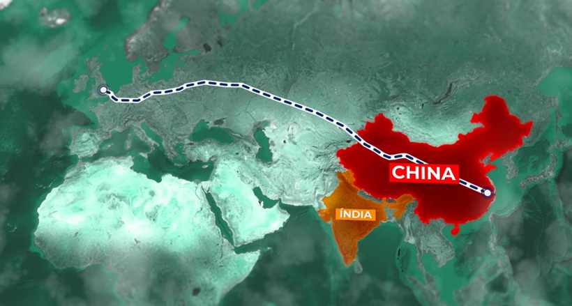
In Pakistan the project is even bigger, with the Chinese building Pakistan’s economic corridor that will feature highways and railways, as well as several industries throughout the country, which worries India, since Pakistan is its biggest enemy. In addition, the Chinese are also building a gigantic railway that will literally link China to the city of London, passing through Kazakhstan, Russia and several European countries, as well as the new silk route that completely bypasses India.
What are the Main Maritime Trade Regions of the Middle East and Asia?
These are basically the most important maritime trading regions in the world:
- The Strait of bab el-mandeb, which links almost all the world’s maritime trade between Europe, Asia and the Middle East.
- The Strait of Hormuz, which connects the major oil producers with the rest of the world.
- The Strait of Malacca, where you have the most economically important countries in Asia.
The point is that China has infrastructure projects in almost all these regions and this could lead to control of these straits and thus ban products coming from India. But in a contraction, India has started working on the diamond necklace strategy.
India Makes Agreement With Singapore
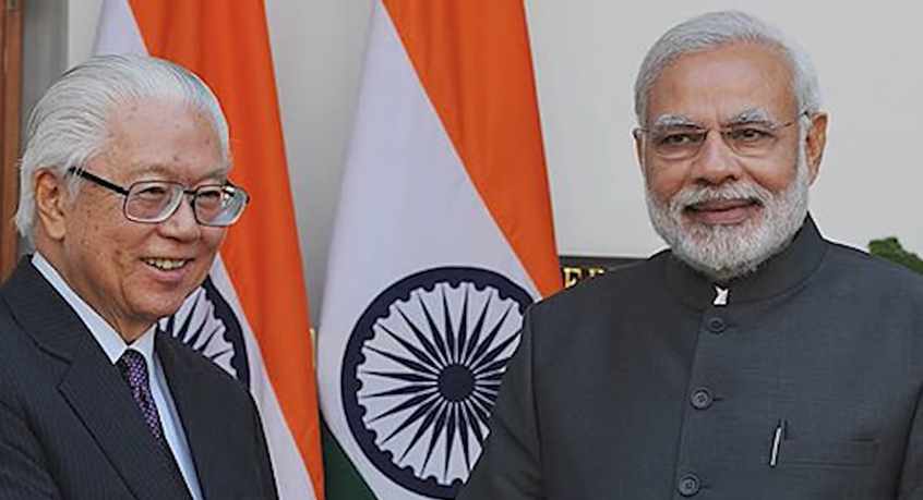
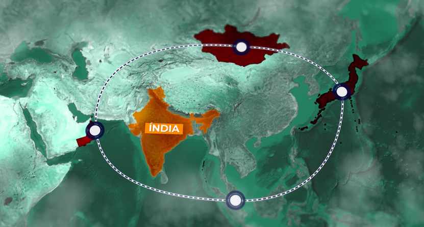
The Indian government is conducting access agreements to strategic military bases around the world. Given that in 2018, Indian Prime Minister Narendra Modi signed the agreement with Singapore for the Indian Navy to be able to refuel its ships and rearm them at that port.
The same happened with the ports of Sabang in Indonesia and Ducme port in Oman. The Indians thus gained access to the Strait of Malacca, where more than 70 per cent of Chinese oil imports and 60 per cent of all Chinese imports pass. The Indian strategy also encompasses cooperation agreements between countries, the first of which is Mongolia, which will have access to the Indian credit line for the country’s development, and later Japan, which together with India will collaborate in the Asia→Africa growth corridor.
The Indian Diamond Necklace
This will result, if we connect all the points mentioned above, in the Indian Diamond Necklace, which can keep the country having its influence in Asia.
And not only that, but it has a detail that worries the Chinese government, the population of India is concentrated in the North Indian states like:
- Bihar;
- Uttar Pradesh;
- Haryana and;
- Punjab.
These Indian states account for almost thirty percent (30%) of India’s population, and on the other side, in China, the exact opposite is the case, with the most populous provinces being:
- Guangdong;
- Shandong and;
- Henan.
All on China’s east coast. In turn, the region closest to India, Tibet has only 3 million inhabitants, being the penultimate most populous administrative region of China. But this huge conflict between China and India is not more intense because of the natural barrier, the truth is that, because it is an extremely mountainous region, the difficulty of access is very high and that is exactly why there are no large military bases in this region, but small strategic points on each side. To have an idea, in the Chinese side, to access the region of AKSAI CHIN there is only one road that stretches to there, G219, which extends through almost all of Tibet.
On the Indian side, on the other hand, there are the largest number of roads stretching across Indian Kashmir. Because both countries have no consensus on borders, they are demilitarised in certain areas and this leads to several physical confrontations between military personnel, as on June 15, 2020, in the Ladakh region, some 300 Indian and Chinese military personnel clashed using only their physical strength and more than 40 military personnel died.
But these conflicts have no date to end, as the tensions and the race to become the biggest and main power in Asia only increase, and with the immense Chinese expansion throughout Asia, this only tends to lead to a worsening of that region, and this was the biggest territorial conflict in the world!


